 how-to
Learning Aviation Meteorology for Dispatchers
Table of Contents
- Why Aviation Meteorology Matters for Dispatchers
- FAA Part 65 Meteorology Requirements and Certification Standards
- Decoding METARs and TAFs for Flight Planning
- How to Analyze Aviation Weather Charts
- Identifying Severe Weather and Convective Activity
- Best Aviation Meteorology Books for Pilots and Dispatchers
- Practical Decision-Making Frameworks for Weather-Related Challenges
- Preparing for the ADX Exam: Meteorology Section
Last Updated: August 30, 2026
Why Aviation Meteorology Matters for Dispatchers
Aviation meteorology isn't optional for aircraft dispatchers, it's the foundation of every flight decision you'll make. A dispatcher who can't read a METAR, interpret a TAF, or spot developing thunderstorms is guessing, and in aviation, guessing gets people killed.
Your job is to ensure every flight departs safely and arrives on schedule. Weather controls both outcomes. You'll authorize flights through marginal conditions, delay departures, reroute aircraft around convective activity, and defend those decisions to pilots, operations managers, and regulators. Without solid meteorology knowledge, you're making those calls blind.
Learning aviation meteorology for dispatchers means mastering three overlapping skill sets: reading raw data (METARs, TAFs, SIGMETs), understanding atmospheric processes that create weather, and translating that knowledge into operational decisions under pressure.
FAA Part 65 Meteorology Requirements and Certification Standards
The Federal Aviation Administration mandates specific meteorology competencies for aircraft dispatchers under 14 CFR Part 65, Subpart C (faa.gov). Part 65 requires that dispatchers demonstrate knowledge of atmospheric pressure, wind patterns, frontal systems, thunderstorm development, icing conditions, and turbulence. You must understand how to interpret synoptic charts, satellite imagery, and radar data, and know the difference between a SIGMET (Significant Meteorological Information) and an AIRMET (Airman's Meteorological Information).
Airlines add their own meteorology standards on top of FAA minimums. Many carriers require dispatchers to complete recurrent training in meteorology annually and pass internal exams before authorizing certain aircraft types or routes.
Learning aviation meteorology through a structured program gives you the conceptual framework needed to pass the ADX exam and, more importantly, to make sound decisions in the operations center. QNH LLC's FAA-approved Part 65 program covers meteorology systematically, using instructors who are former FAA examiners and experienced airline pilots.
Decoding METARs and TAFs for Flight Planning
Reading METAR Reports
A METAR is a standardized weather report issued every hour (or every 30 minutes during active weather) from airports worldwide (icao.int). It's the raw data you'll consult dozens of times during your shift.
The format looks cryptic: "KJFK 121851Z 31008KT 10SM FEW250 23/14 A3012 RMK AO2 SLP201 T02330139." But it's a compressed data stream. The station identifier (KJFK) tells you the airport. The time (121851Z) is when the observation was taken in UTC. The wind (31008KT) means 310 degrees at 8 knots. Visibility (10SM) is 10 statute miles. Cloud layers (FEW250) mean scattered clouds at 25,000 feet. Temperature and dew point (23/14) are in Celsius. Altimeter setting (A3012) is 30.12 inches of mercury.
The remarks section (RMK) contains additional details: equipment type, sea-level pressure, and precise temperature/dew point in tenths of degrees. That precision matters when calculating aircraft performance or assessing icing risk.
Common mistakes include confusing altimeter setting with barometric pressure, misreading wind direction, or ignoring the RMK section. A METAR reporting "3SM +SN BKN020 OVC040" (3 statute miles, heavy snow, broken clouds at 2,000 feet, overcast at 4,000 feet) tells you the airport is marginal and deteriorating.
Understanding TAF Forecasts
A TAF (Terminal Aerodrome Forecast) extends the METAR into the future, typically 24 to 30 hours for domestic airports (faa.gov). While a METAR tells you what's happening now, a TAF predicts what will happen. For flight planning, the TAF is often more important.
TAF format follows METAR structure but with time groups that break the forecast into segments. You'll see "KJFK 121720Z 1218/1324" which means this TAF was issued at 1720 UTC on the 12th and covers 1800 UTC on the 12th through 0000 UTC on the 13th.
Within the forecast period, you'll find change groups: "TEMPO" (temporary, lasting less than an hour), "BECMG" (becoming, a gradual change), or "PROB" (probability, used for lower-confidence forecasts). A TAF reading "TEMPO 1820/1824 3SM -RA" means expect temporary conditions of 3 statute miles visibility with light rain between 1820 and 1824 UTC.
The critical skill is trend reading. A TAF showing improving visibility and decreasing winds suggests the airport will become more favorable as the day progresses. A TAF showing deteriorating conditions and VFR transitioning to MVFR at 1400Z tells you to plan for earlier arrivals or expect delays.
How to Analyze Aviation Weather Charts
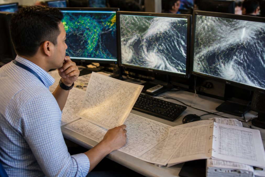
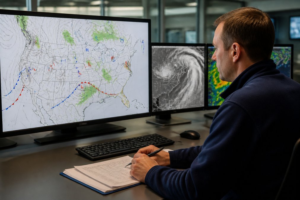
Synoptic charts, satellite imagery, and radar are the visual languages of aviation meteorology. A synoptic chart plots atmospheric pressure systems, fronts, and pressure patterns across a region. High-pressure systems (H) typically bring stable weather; low-pressure systems (L) bring instability and potential for severe weather. Cold fronts (marked with blue triangles) move faster and often trigger thunderstorms. Warm fronts (red semicircles) bring gradual weather changes and icing layers.
Satellite imagery shows cloud patterns in real time. Water vapor imagery reveals moisture in the atmosphere and upper-level winds. Infrared imagery works day and night and shows cloud-top temperatures, which correlate with cloud height and intensity.
Radar is your window into convective activity. Reflectivity shows precipitation intensity; velocity shows wind speed and rotation. A radar signature with high reflectivity, a hook echo, and strong rotation indicates a tornado-producing storm.
The skill is integration. You're not reading these charts in isolation. A synoptic chart showing a dryline combined with satellite imagery showing cumulus towers and radar showing developing reflectivity means thunderstorms are likely. That combination of signals matters more than any single chart.
Identifying Severe Weather and Convective Activity
Thunderstorms require three ingredients: moisture, instability, and a lifting mechanism. Moisture comes from warm, moist air near the surface. Instability means the atmosphere is layered such that rising air continues to rise. Lifting mechanisms include fronts, drylines, mountains, and sea breezes.
When all three are present, convective activity develops. A single cell becomes a multicell cluster. Clusters organize into supercells, rotating thunderstorms that produce severe hail, damaging winds, and tornadoes. A supercell on radar shows a clear rotation signature and often a hook echo.
The operational question isn't "Is there a thunderstorm?" but "Is it severe, and is it moving toward my route?" A scattered air mass thunderstorm moving away from your planned flight path is manageable. An organized supercell complex moving across your departure airport is a reason to delay.
SIGMETs and AIRMETs alert dispatchers to significant weather. A SIGMET covers severe turbulence, severe icing, or dust storms. An AIRMET covers moderate turbulence, moderate icing, or sustained surface winds of 30+ knots. Neither is a prohibition; they're notifications you need to factor into your decision.
Best Aviation Meteorology Books for Pilots and Dispatchers
Structured learning beats random experience. "Aviation Weather" (FAA) is the regulatory baseline. It's dense and technical, covering everything the FAA expects you to know. "Meteorology for Aviators" is written specifically for aviation professionals and explains atmospheric processes in operational language. "Weather for the IFR Pilot" covers icing, turbulence, thunderstorms, and wind shear from an operational perspective.
For deeper understanding, "An Introduction to Dynamic Meteorology" covers the physics behind weather systems. Dispatchers who work through it develop intuition about why weather behaves the way it does.
Reading alone won't make you a competent dispatcher. You need to apply the knowledge, analyzing real METARs, interpreting actual synoptic charts, and making decisions about flights you're dispatching. QNH LLC's Part 65 program combines meteorology instruction with practical application, taught by instructors who've worked dispatch themselves.
Practical Decision-Making Frameworks for Weather-Related Challenges
Theory is foundational. Execution is everything. A dispatcher facing a developing weather system needs a framework for deciding whether to delay, reroute, or proceed.
The Three-Source Integration Rule: Before making a weather-related dispatch decision, consult three independent sources. Check the METAR and TAF for the destination airport. Check the synoptic chart and satellite imagery for the region. Check the radar for current convective activity. If all three sources align, the decision is straightforward. If sources conflict, dig deeper.
The Trend Analysis Framework: Weather is dynamic. Look at the trend. Is visibility improving or deteriorating? Are winds increasing or decreasing? Is the altimeter setting rising or falling? Pressure falling and winds increasing suggest a low-pressure system approaching; expect worse conditions soon.
The Risk Tolerance Matrix: Your airline sets operational minimums. But minimums aren't always the right threshold. A destination forecast to be at minimums with a deteriorating trend is riskier than one above minimums with an improving trend. Evaluate not just current conditions but the trajectory.
The Delay-vs.-Reroute Decision: When weather blocks your planned route, you have two options: delay and wait for improvement, or reroute around the weather. Delaying works if the weather is moving through. Rerouting works if an alternate path is available and fuel permits. A fast-moving cold front might clear in two hours; delay. A stationary low-pressure system might linger; reroute.
Preparing for the ADX Exam: Meteorology Section
The Aircraft Dispatcher certification exam (ADX) includes a substantial meteorology component. The exam tests your ability to read and interpret aviation weather data under time pressure.
You'll encounter METARs with missing or unusual elements and need to identify what they mean operationally. You'll see synoptic charts and be asked to predict weather development. You'll review TAF sequences and determine when conditions will deteriorate. You'll analyze radar signatures and identify severe weather threats.
The meteorology section is applied, not theoretical. Examiners ask questions like: "This TAF shows TEMPO 1820/1824 3SM -RA BECMG 1824/1826 5SM RA. Your flight is scheduled to arrive at 1830. What do you expect?" The answer requires understanding that temporary conditions improve to marginal, and your arrival will likely be in marginal conditions with rain.
Common exam mistakes include misreading wind direction, missing the significance of a pressure trend, or confusing SIGMET and AIRMET criteria. Preparation requires practice interpreting real METARs, TAFs, and charts under time constraints. QNH LLC's ADX prep program includes meteorology drills, simulated exam scenarios, and feedback from instructors who've administered the actual exam.
Learning aviation meteorology for dispatchers is an investment in your ability to make sound decisions under pressure. Each weather event you analyze, each decision you defend, and each exam question you answer builds your competency. Start with the fundamentals: METARs, TAFs, synoptic charts. Progress to integration and decision-making. QNH LLC's Part 65 program is structured to take you through that progression systematically, with instructors who've lived the operational realities you'll face. Reserve now and start building the meteorology foundation that separates competent dispatchers from exceptional ones.
Frequently Asked Questions
What specific meteorology topics are required for FAA Part 65 certification?
FAA Part 65 certification requires mastery of atmospheric pressure systems, wind shear, icing conditions, turbulence, and convective activity. You must understand how to decode METAR and TAF reports, interpret synoptic charts, and analyze SIGMET and AIRMET alerts. The certification also covers aeronautical decision-making frameworks that incorporate meteorological data into flight planning and dispatch decisions. Small-class instruction with experienced instructors ensures you grasp these topics thoroughly, not just memorize them.
How do aircraft dispatchers use weather forecast discussions in flight planning?
Dispatchers use forecast discussions from the National Weather Service to understand the reasoning behind meteorological predictions and identify emerging weather threats before they appear in standard METAR or TAF reports. These discussions explain pressure system movements, convective development potential, and atmospheric instability, critical for proactive flight planning. By analyzing forecast discussions alongside current observations, dispatchers make informed decisions about route planning, altitude selection, and fuel requirements, reducing weather-related delays and safety risks.
What's the difference between a TAF and a GFA for flight planning purposes?
A TAF (Terminal Aerodrome Forecast) provides detailed weather predictions for a specific airport over 24-30 hours, including wind, visibility, and weather phenomena. A GFA (Graphical Forecast for Aviation) shows weather systems and hazards across a broader geographic area, helping dispatchers understand regional weather patterns and severe weather potential. Dispatchers use TAFs for airport-specific planning and GFAs for route selection and strategic flight planning decisions across multiple waypoints and alternate airports.
How confident can I be that after 200 hours of training, I'll actually be ready to defend a flight plan in front of an examiner?
The 200-classroom-hour curriculum at QNH LLC is structured around practical application and aeronautical decision-making, not just knowledge recall. You'll work through real-world scenarios, analyze actual weather charts, and practice defending flight plans under pressure. Instructors who are former FAA Dispatcher Examiners know exactly what the ADX exam requires and how examiners evaluate your reasoning. Small class sizes mean you receive individual feedback on your decision-making process, building the confidence and competence needed to pass and excel as a working dispatcher.
This article was written using GrandRanker